

Hotline: 015 59 55 98
088 5999 009
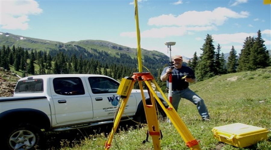
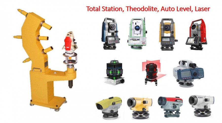
A surveyor using a total station Surveying or land surveying is the technique, profession, and science of determining the terrestrial or three-dimensional positions of points and the distances and angles between them. A land surveying professional is called a land surveyor. These points are usually on the surface of the Earth, and they are often used to establish maps and boundaries for ownership, locations, such as building corners or the surface location of subsurface features, or other purposes required by government or civil law, such as property sales. Surveyors work with elements of geometry, trigonometry, regression analysis, physics, engineering, metrology, programming languages, and the law. They use equipment, such as total stations, robotic total stations, theodolites, GPS receivers, retroreflectors, 3D scanners, radios, handheld tablets, digital levels, subsurface locators, drones, GIS, and surveying software. Surveying has been an element in the development of the human environment since the beginning of recorded history. The planning and execution of most forms of construction require it. It is also used in transport, communications, mapping, and the definition of legal boundaries for land ownership. It is an important tool for research in many other scientific disciplines.
We offer qualify superior pre-sale service to help you choose the right goods, highclass after service to ravel out your concerns,and life long technical support.
Read More...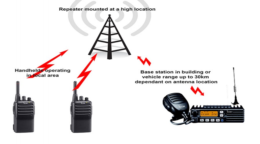
If you are an individual, or a member of an organisation, that already uses radios but wants to get more out of them,
Read More...
Asiacom មានការទទួលខុសត្រូវខ្ពស់ យកចិត្តទុកដាក់ខ្ពស់ក្នុងការបម្រើសេវាក្រោយពេលលក់ ដែលជាចំណែកដ៏សំខាន់មួយជួយអោយមាននិរន្តរភាព...
Read More...